Current Central Arkansas NOAA Weather Wire Products
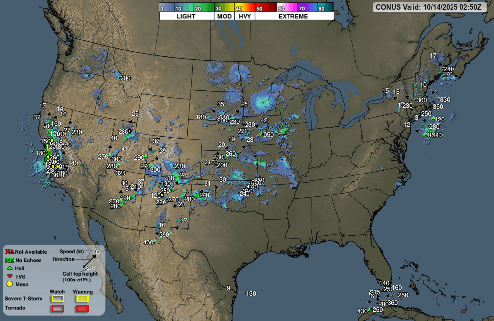
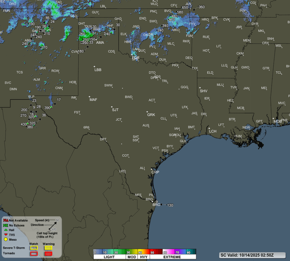
Above -- The Latest Real Time Official Public Domain ENHANCED RIDGE 250 N. MI. Range Base Reflectivity Looping Mosaic From Arkansas's 9 Regional National Weather Service (NWS) NEXRAD WSR-88D Doppler Weather Radar Sites Located Near: Tulsa, OK., Springfield, MO., Paducah, KY., Fort Smith, AR., North Little Rock, AR., Memphis, TN., Shreveport, LA., Ft. Polk, LA., &, Jackson, MS. Use The Pull Down Menu In The Map To Access & Tailor Products.
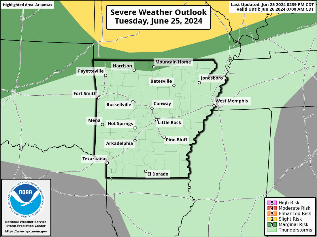
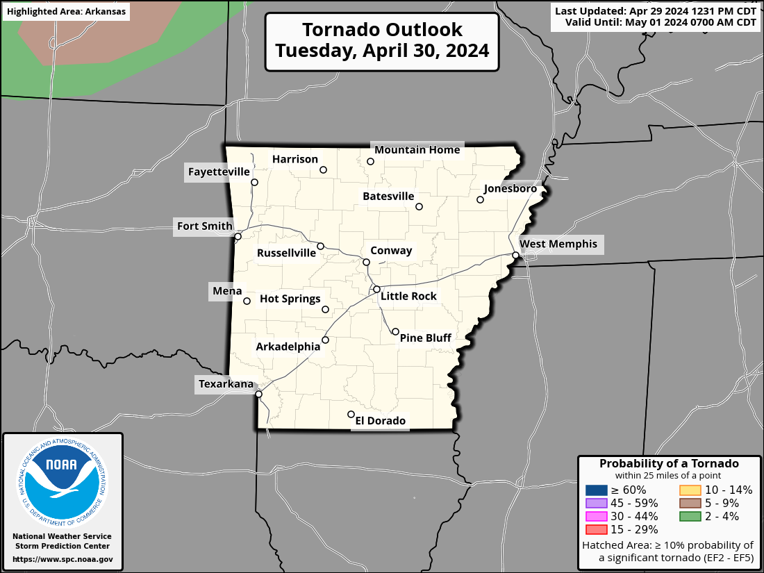
Current Arkansas Watches & Warnings
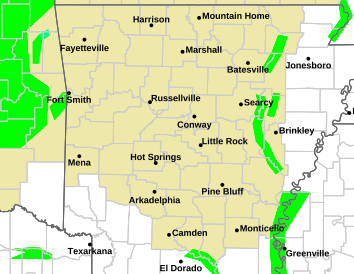
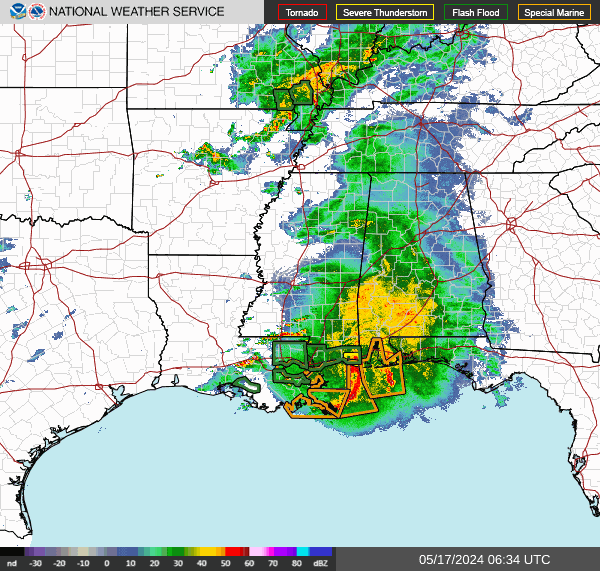
Above -- The Latest Real Time Official Public Domain Standard RIDGE Looping Imagery From Arkansas's 9 Regional National Weather Service (NWS) NEXRAD WSR-88D Doppler Weather Radar Sites Located Near: Tulsa, OK., Springfield, MO., Paducah, KY., Fort Smith, AR., North Little Rock, AR., Memphis, TN., Dallas - Ft. Worth,TX., Shreveport, LA., & Jackson, MS. Click On The Thumbnail Images To Go To Corresponding Imagery.
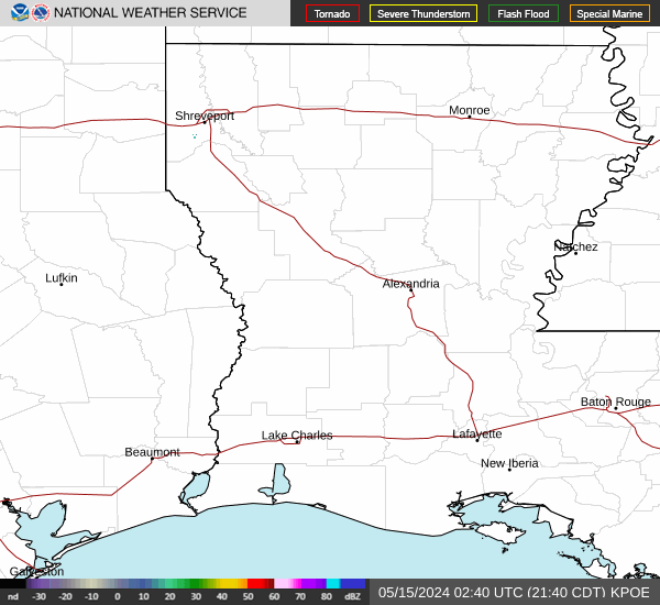
Above -- The Latest Real Time Official Public Domain ENHANCED RIDGE 250 N. MI. Range Base Reflectivity Imagery From Arkansas's 9 Regional National Weather Service (NWS) NEXRAD WSR-88D Doppler Weather Radar Sites Located Near: Tulsa, OK., Springfield, MO., Paducah, KY., Fort Smith, AR., North Little Rock, AR., Memphis, TN., Shreveport, LA., Ft. Polk, LA., &, Jackson, MS.. Click On The Colored Circles To Go To Corresponding Radar Sites. Purple Circles Indicate Active Radar & Red Circles Indicate A Radar Outage. Use The Pull Down Menu In The Map To Access & Tailor Products.
Above - New Madrid Modified Mercali Earthquake Estimate Based On A Richter Scale 7.7 Map For Arkansas. Use The Roman Numeral Scale On The Map & Chart To Estimate.
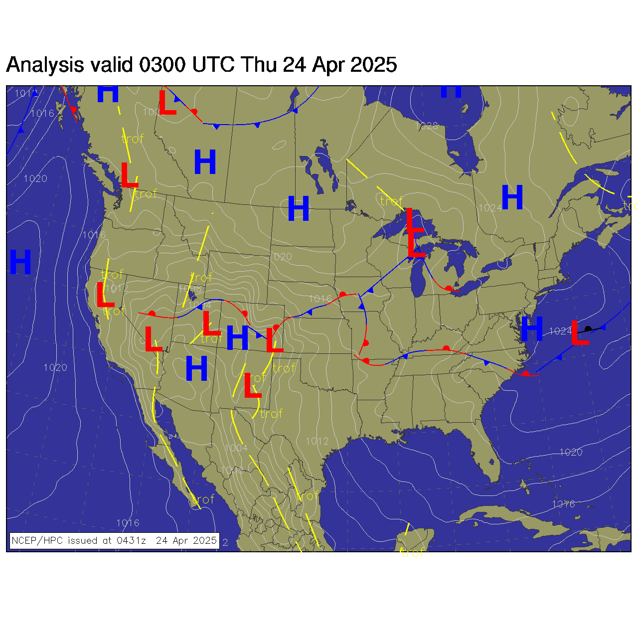
Above - The Latest NWS Arkansas Digital Weather Forecast Information In GIS Interactive Format.
Current Arkansas NBM STATION DATA VIEWERCurrent NBM GRAPHIC ProductsCurrent NBM ALPHANUMERIC TEXT ProductsCurrent NCEP MAG GLOBAL WEATHER MODEL PRODUCTS
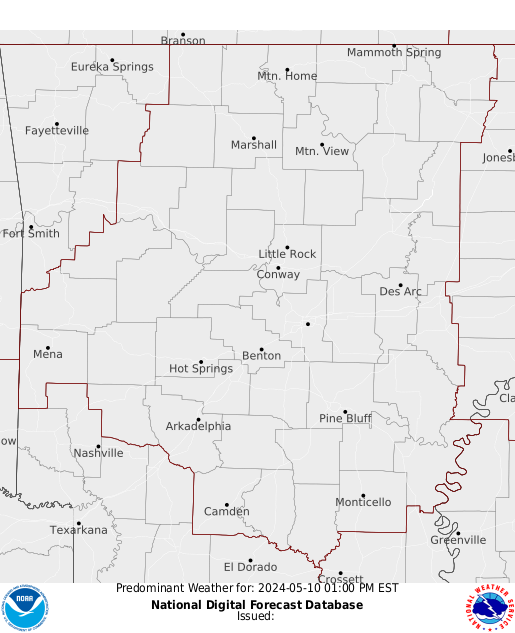
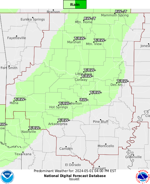
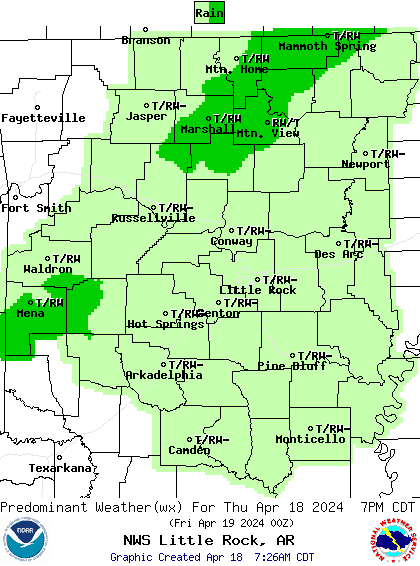
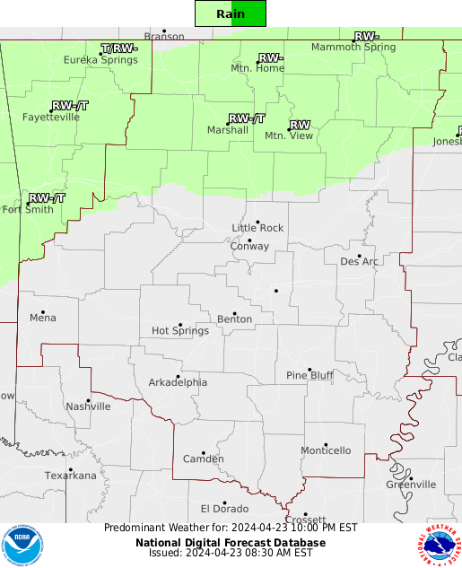
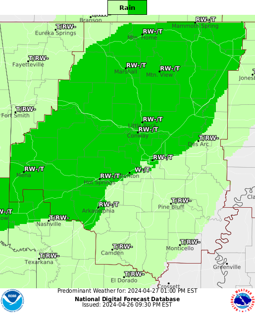
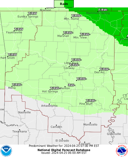
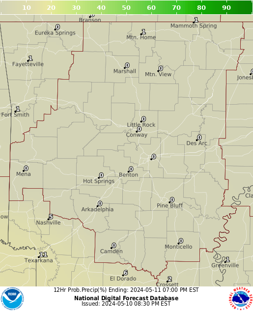
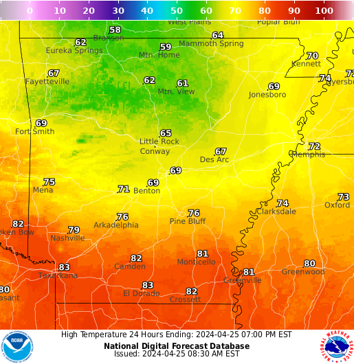
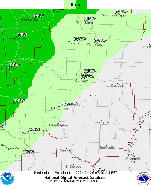
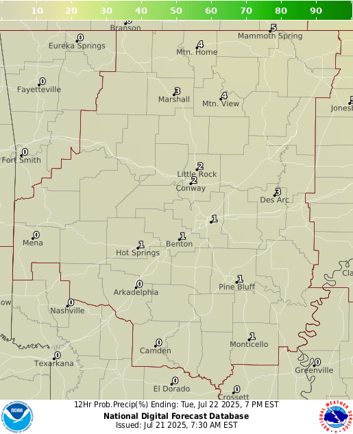
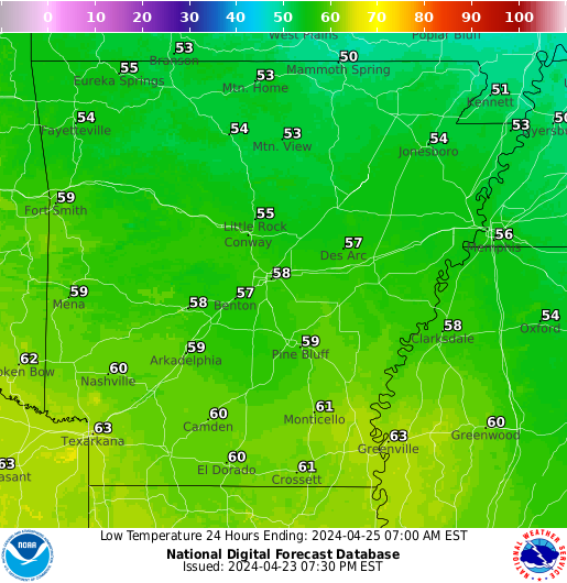
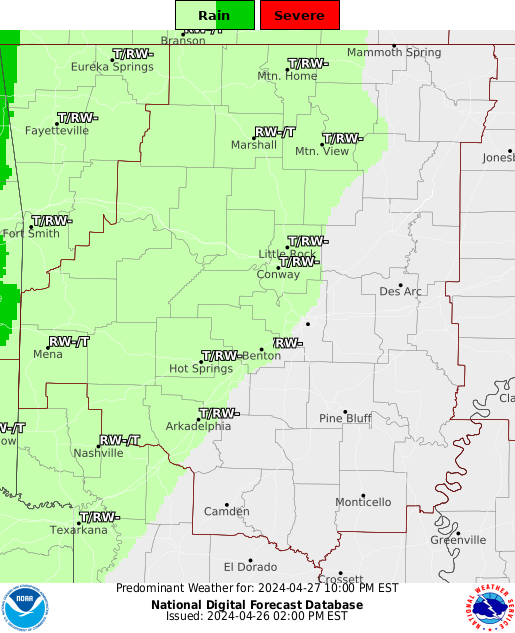
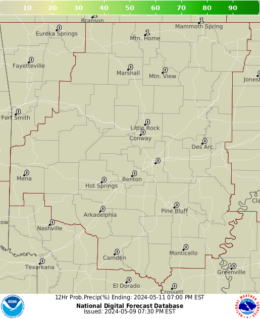
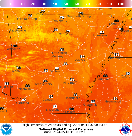
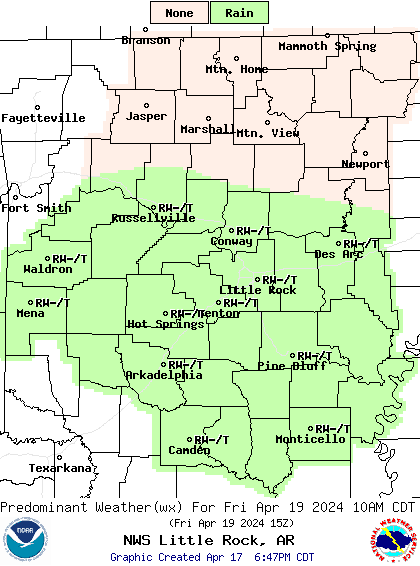
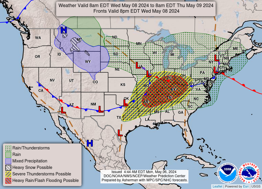
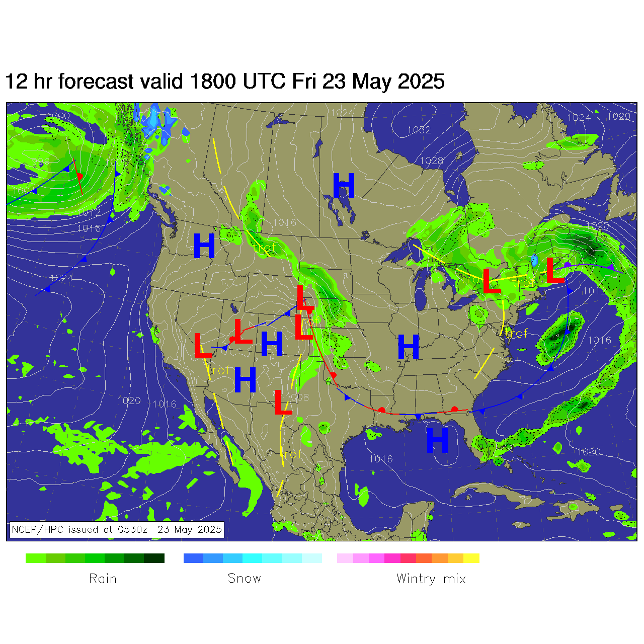
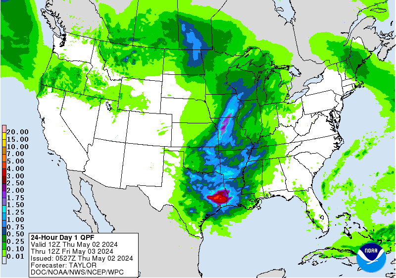
Above - NWS LZK's Day 1 Predominant Weather, Precipitation Probability, & High & Low Forecast Maps.
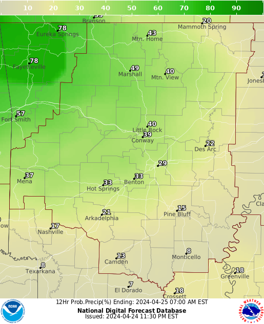
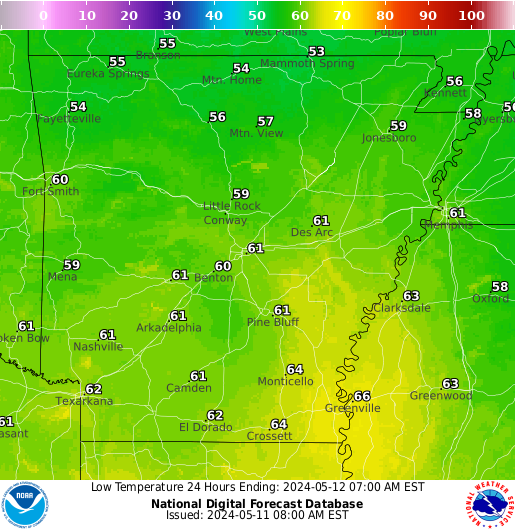
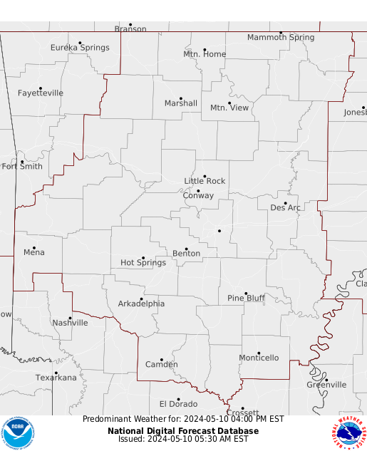
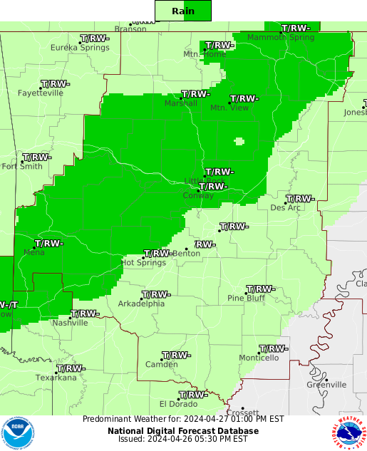
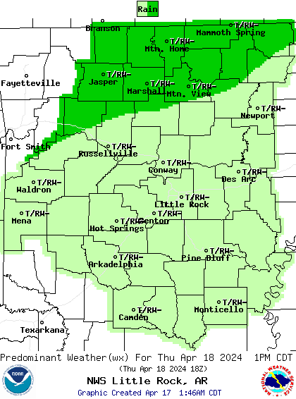
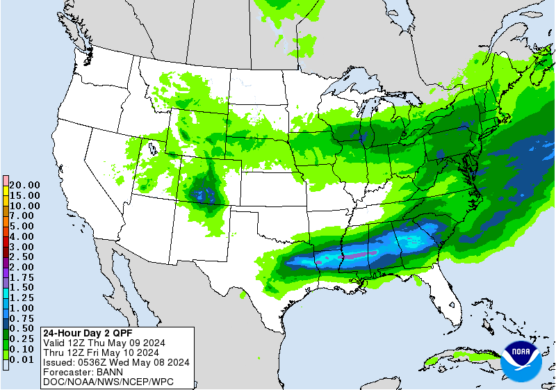
Above - NWS LZK's Day 2 Predominant Weather, Precipitation Probability, & High & Low Forecast Maps.
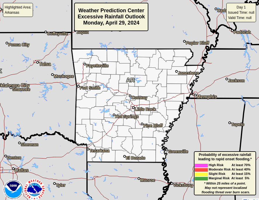
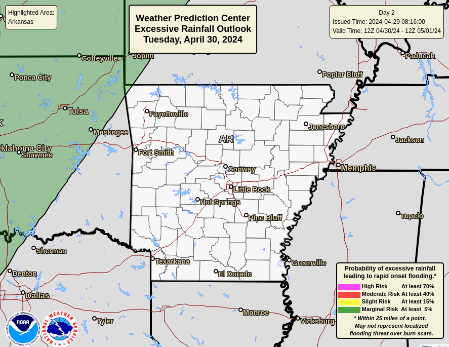
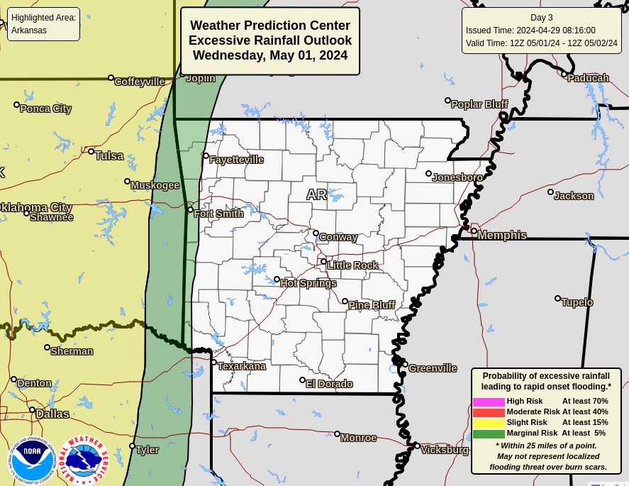
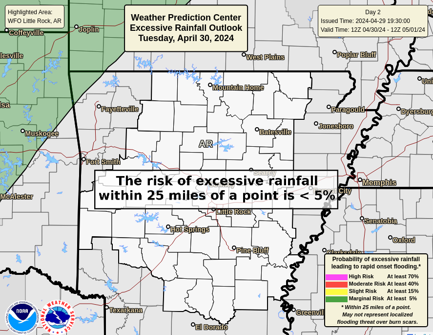
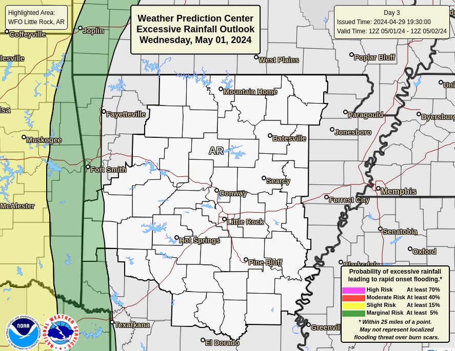
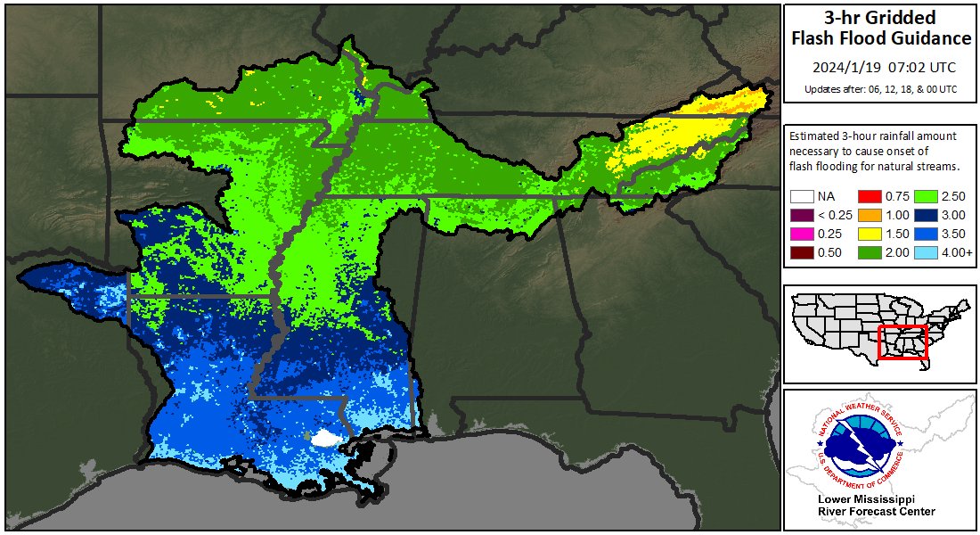
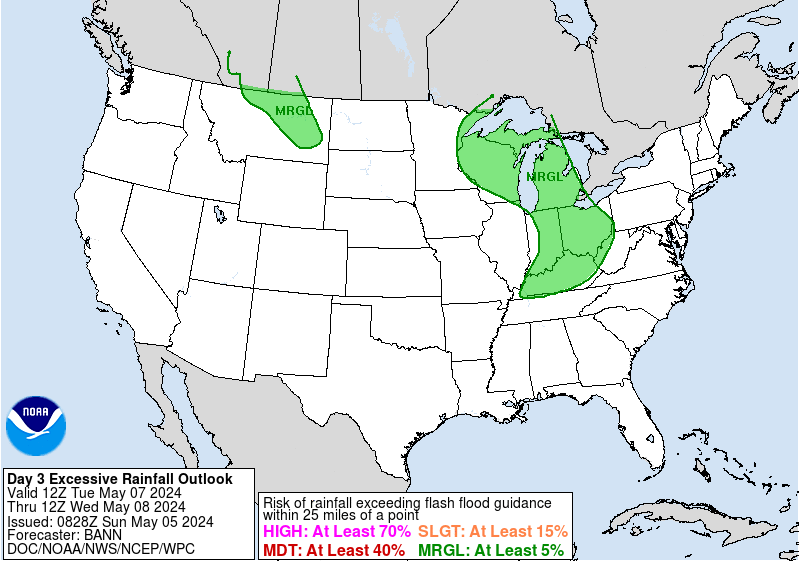
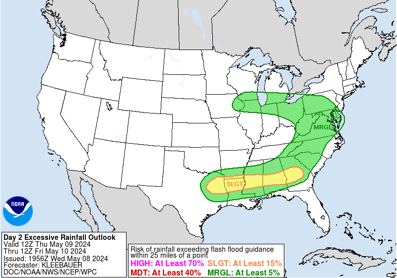
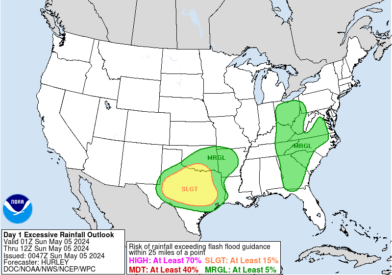
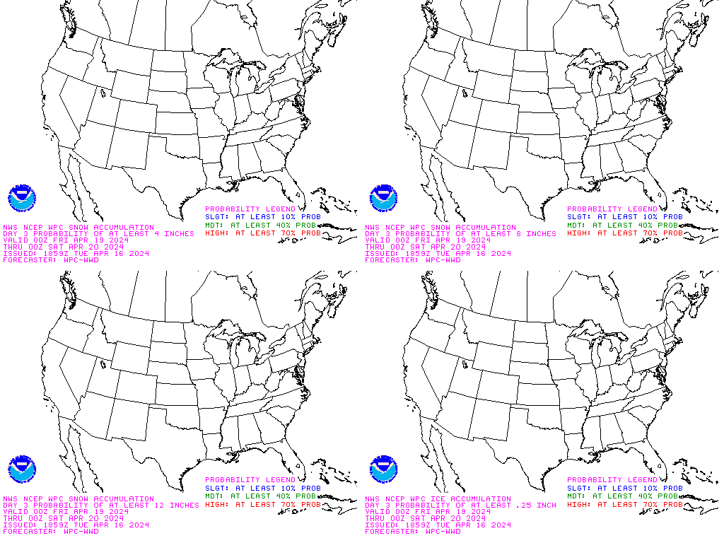
Above - Click To View The NWS (WPC) Excessive Rainfall Categories. Click Here To Read The Latest NWS Weather Prediction Center (WPC) Excessive Rainfall Discussion.
Above -- The Latest Real Time Official Public Domain ENHANCED RIDGE 250 N. MI. Range Base Reflectivity Imagery From Arkansas's 9 Regional National Weather Service (NWS) NEXRAD WSR-88D Doppler Weather Radar Sites Located Near: Tulsa, OK., Springfield, MO., Paducah, KY., Fort Smith, AR., North Little Rock, AR., Memphis, TN., Shreveport, LA., Ft. Polk, LA., &, Jackson, MS.. Click On The Colored Circles To Go To Corresponding Radar Sites. Purple Circles Indicate Active Radar & Red Circles Indicate A Radar Outage. Use The Pull Down Menu In The Map To Access & Tailor Products.
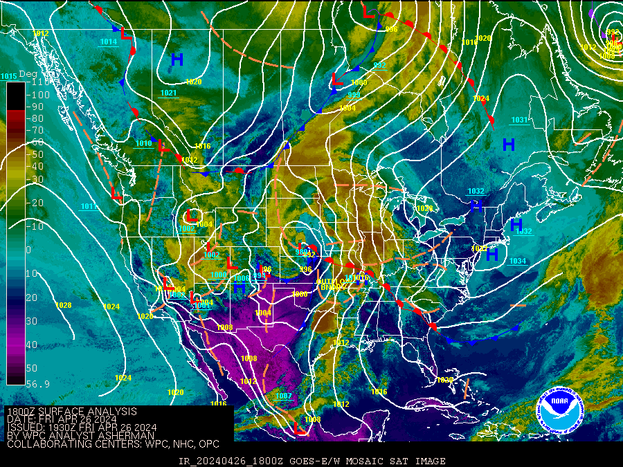
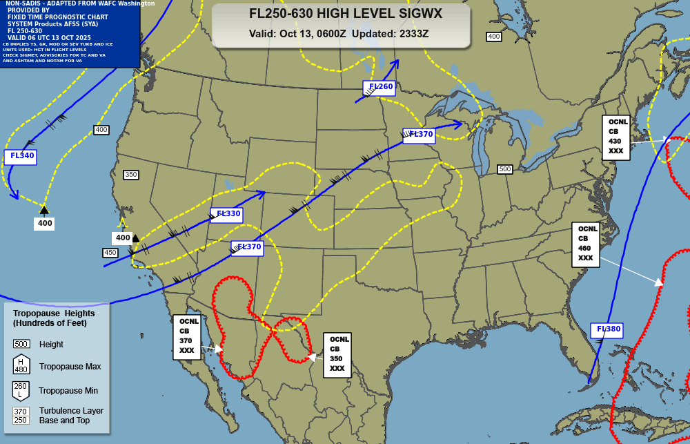
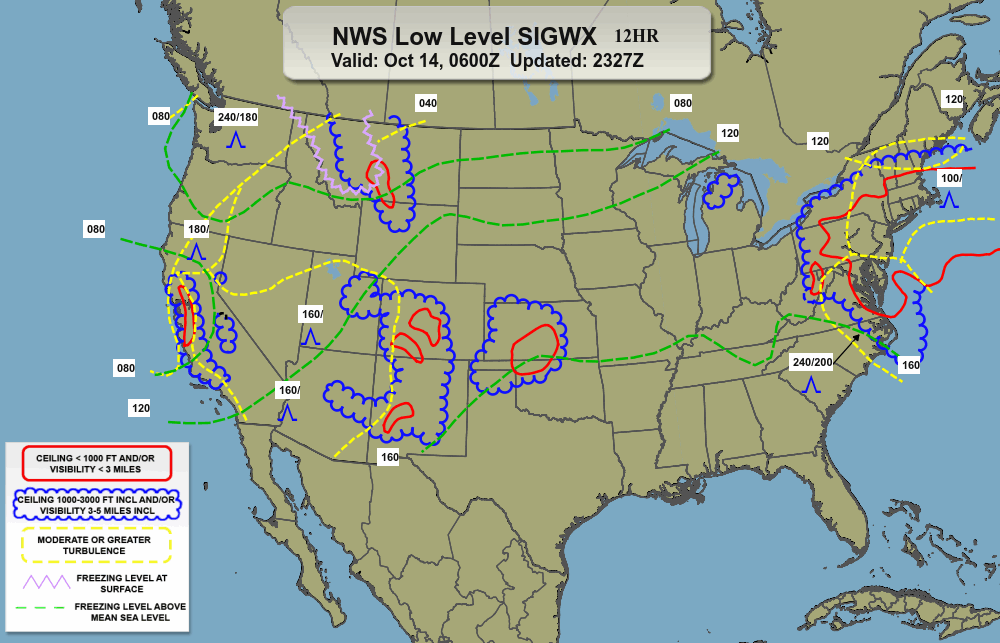
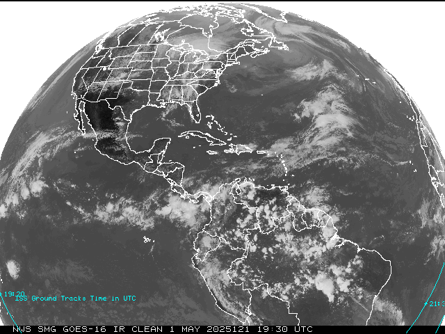
Above: Click These NWS GOES-16 CONUS IMAGERY (Left - Water Vapor) (Center - Infrared ) & (Right - Geostationary Lightning Mapper) To Enlarge & Loop Them.
- Follow My Tweets On Twitter - @DamonCPoole2. Also, See The Facebook Badge For All My Social Media Connections, & Punch The LinkedIn Button To See My Profile.
Site Disclaimer - This site provides links to other weather information sites and in no way, shape, form, or fashion, attempts to copy any other site's material. These links take the viewer directly to the linked sites. All National Weather Service and other Federal and State Government Linked Sites are in the Public Domain and are not copyright protected. Unless otherwise specified, information on each private or corporate linked site is intended for personal use only. Copyright belongs to the owners of each site, and content is solely their responsibility. This is an absolutely non-commercial, non-profit, free access site. There are absolutely no guarantees, warrantees, endorsements, or other business entanglements of any kind attached to this site. Please do not rely solely upon the internet for critical weather warnings and other emergency information. The internet should be used for basic information and planning purposes only. Instead, use official sources such as NOAA Weather Radio, The Emergency Alert System on Local TV and Radio Stations, and, The National Weather Service. Not only are these more reliable, they also allow you to receive data in shelter, which is where you belong in severe weather. Also, computers are prone to lightning damage when on-line during a thunderstorm. For your safety, never use the computer, or the phone during a lightning storm. Enjoy your visit! Damon C. Poole II, Webmaster. (C)2023 damon@weather4ar.org.


 The T'Storm & Tornado Crossing Graphics by (C) Todd L. Sherman / KB4MHH. Skywarn Logo (C) NOAA-NWS.


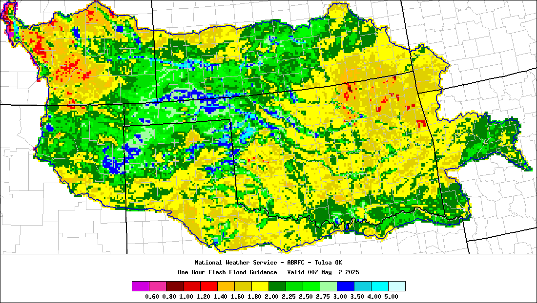
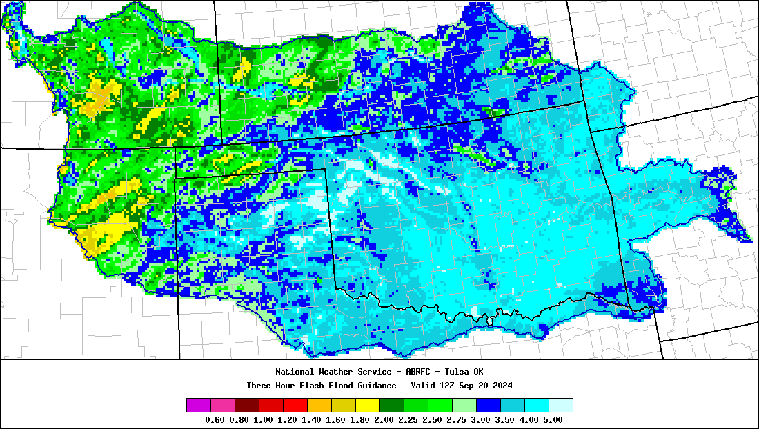
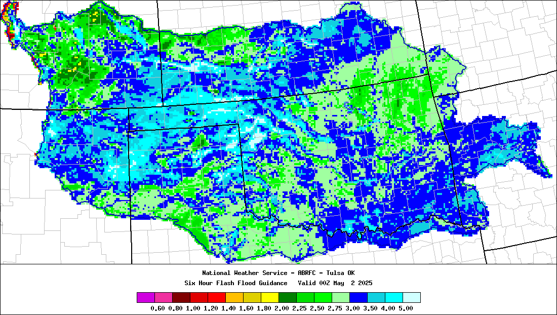


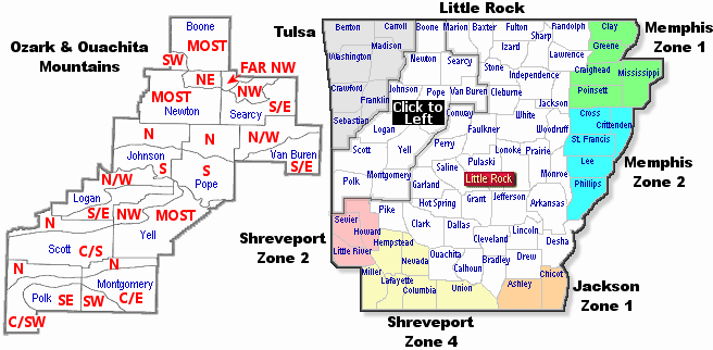


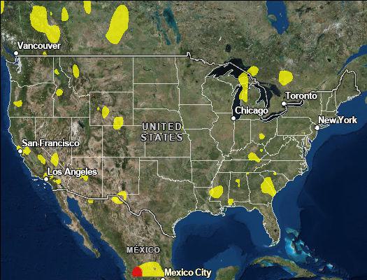
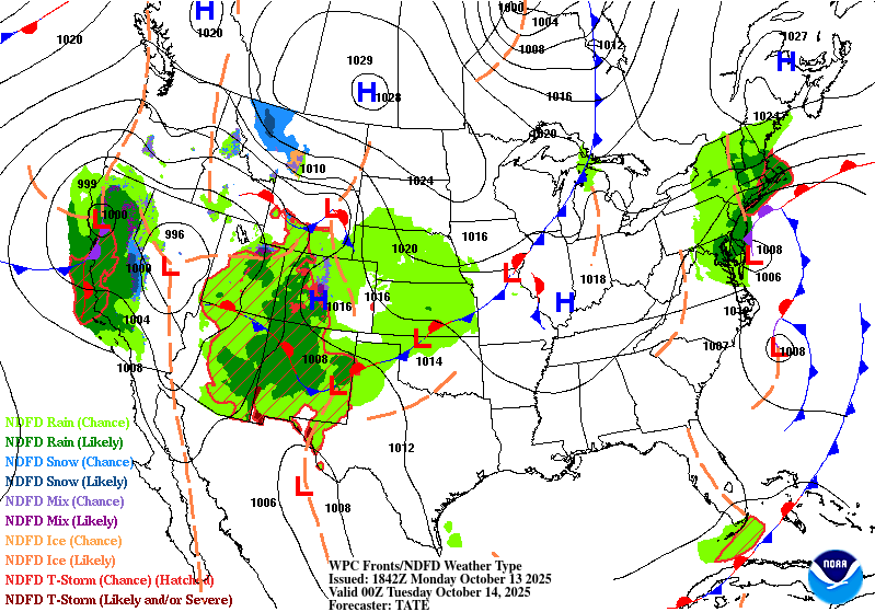
 Above - Click On The Left Map For


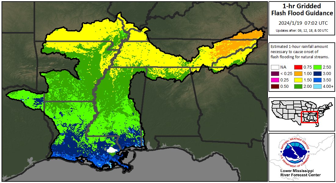
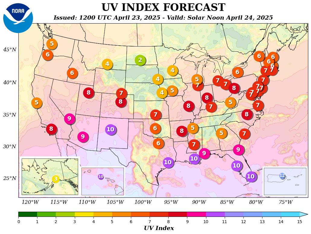
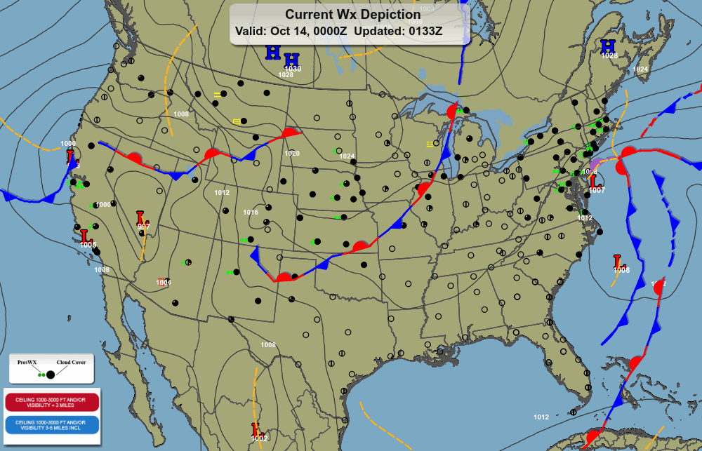
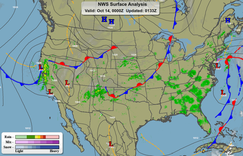
 Above Left:


